TRIPS FOR 2025
1. May 6th-12th Wimmera River.
Places to include:- Ararat, Mt Cole, Northern Pyrenees, Dimboola and Wyperfeld NP.
(Further update in April)
The Wimmera River rises in the central Victorian Pyrenees and flows, sporadically, north-west towards the Wyperfeld National Park. This trip uses the river as the theme for a tour of its countryside.
Date Accommodation Activities
Tue 6 May 3 nights
Ararat G’Day caravan park:To Ararat, Around the Pyrenees
Fri 9 May 3 nights Dimboola Riverside caravan park
Meandering to Dimboola: The dry county
Mon 12 May To home
Contact Brendan 0438 619 625 br845324@gmail.com
4WD Wimmera River Trip Report
Tue 6 May – Mon 12 May, 2025
Barry and Chris, Chris and Pat, Bruno and Julia, Stuart and Edith and Brendan and Val met at Ararat. Ron joined us later at Dimboola.
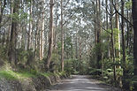
On Wednesday we climbed into the high country of the Pyrenees, close to Mount Cole, and had morning tea at a steep gully close to the source of the river. A tour along the upper reaches of the river was modified due to a new ford under construction at the river crossing.
Near the source of the river Cameron Track Campsite
Further south, Richard’s Campground provided access to walking trails, which some hardy souls checked out in light rain. The lame and halt made a fire to warm and dry the walkers. By lunchtime the showers had cleared.
At Langi Ghiran State Park we walked up to the reservoir.
After dinner, games.
On Thursday we took a track on the ridge of the Pyrenees State Forest to Cameron Track Campsite for morning tea. Proceeded to Governor Rock lookout and Avoca Falls (just add water!). After lunch we walked around the historic precinct at Moonambel, mooning over the portable lockup, the charge book and the human sundial. Finished the day with refreshments at Summerfield Winery.
At Governor Rock lookout Moonambel human sundial
On Friday (moving day) everyone chose different ways to get the caravans to Dimboola for happy hour. Some chose to visit wineries, others to drive direct and have a leisurely lunch on the way. We visited the Gum San Chinese Heritage Centre and then followed the course of the river. At Dimboola we were greeted by hundreds of corellas celebrating sunset and sunrise with enthusiasm.
Corellas at Dimboola Caravan Park Main Street, Rainbow
On Saturday it was difficult to find anyone in the tennis scene on the Arcona Silo Art. Perfect weather made morning tea in the Main Street of Rainbow a pleasure. We continued north to another Silo Art spot and then to the “shore” of Lake Albacutya. Water is added only occasionally by the river. This is the place where the river sinks into the sands of Wyperfeld National Park.
At Jeparit, on the river, we spotted some water, before dispersing to a walk by the river or visiting historic sites in town. Menzies Square commemorates a prime minister’s birthplace.
On Sunday we played in the sand just south of Dimboola where the river crosses the eastern fringe of the Little Desert National Park.
Little Desert National Park Mount Arapiles
On to Mount Arapiles where the Sunday rock-climbers were busy on the mountain walls. After lunch at the summit picnic ground a short climb to the lookout revealed countryside extending forever.
At Horsham the regional gallery had a small exhibition of colonial paintings of the Wimmera district.
We had dinner at the Dimboola hotel in a unique dining-room setting.
Thanks to everyone who contributed to the trip, including games organisers, those who arranged the dinner and Julia and Val for the pictures.
Brendan.
2. May 14th Normanton.
Depart mid May 2025.
Broken Hill, Sturt Steps route to Cameron Corner, Windorah, Lark Quarry, Winton, Normanton Rodeo and beyond.
An easy-going camping trip. No towing. Number of vehicles is limited.
Organiser: Ron.
Please contact Ron direct on swero45@gmail.com.
3. October 20th - 26th Gellibrand
We will be staying at Otways Tourist Park, Gellibrand, for 6 nights from Monday 20 Oct, departing on Sunday 26 Oct. We will visit some of the features within the Otway Ranges, and drive parts of the Great Ocean Road and surrounding countryside.
Contact Brendan 0438 619 625. br845324@gmail.com
Trip Report:
It was rather damp when we arrived at the caravan park in Gellibrand & that periodic wet weather stayed with us for most of our stay. On Tuesday morning we lined up for our first day trip at 9.15am as asked. It was cool but not wet. Using a mixture of sealed & gravel roads we made our way to Lake Elizabeth & morning tea. For those who felt inclined there was a one hour walk down to the lake. It was a pretty sight, tucked away in the folds of a valley & sheltered from the wind. Back on the road we drove to Stevenson’s Falls via an interesting circuitous forest route where one could easily imagine the bullocks pulling a log dray up the hills urged on by the cries of the bullockies. The falls were equipped with tables & seating which made it a good spot for lunch. After lunch we made our way to the Otway Fly for a treetop walk. There were a number of activities to choose from & the efficient staff soon had all participants equipped with the gear appropriate for their chosen activity. An hour or so later they returned with wide grins & complimentary comments about their experience. After that excitement we made our own way back to camp.
On Wednesday we awoke to heavy rain & strong wind, undeterred it was decided to alter the program & make our way to Apollo Bay via sealed roads stopping at Forrest, of Back Roads fame, for morning tea. Forrest has established itself as a hub for mountain bike riders. It has an excellent picnic area which features the usual BBQs, tables & seating + lots of information & maps of the bike tracks through the forest. There is also advice on how to ride safely under what could be challenging conditions. After morning tea, we lined up & continued on through the forest to the Great Ocean Road & Apollo Bay. Some drivers made a small diversion to get fuel; others drove to the Information Centre & parked. There was a variety of lunch spots, easy access to the beach for a short walk & the sun came out. After promenading along the main street, we drove NW along the Great Ocean Rd to Laver’s Hill & from there we made our way back to Gellibrand. Thanks to Chris & Pat, who allowed us to come to their cabin for some evening entertainment. David & Beth provided us with a film called, “Around the Universe".
On Thursday the weather started out fine & sunny. We drove south towards Skene’s Creek, then left for Lorne, Anglesey & Bells Beach along another section of the Great Ocean Road. Morning tea was at Kennet River. It is a small settlement with a café, toilets & some picnic tables. It also had some very hungry birds, mostly King Parrots & Sulphur Crested Cockatoos, which were quick to attempt to sample any unguarded morning tea. Across the road was a beach which gave those who desired a chance to take a short walk. On the beach was a Council rubbish bin with a sign which exhorted walkers to rip out a spurge to rid the beach of this exotic weed, it was full. Back on the road which was quite winding those in the leading cars saw an echidna snuffling along the side of the road. We stopped west of Anglesey to inspect the memorial erected to commemorate the workers who built the road. It started after the First World War to provide work for returning servicemen & was completed in 1932. Bells Beach looked quite frightening, talk about taking your life in your hands!! Are surfers mad? Lunch was on the foreshore in Lorne. From there we drove back to Anglesey & had country drive to Colac via Birregurra. The stop in Colac gave people a chance to get fuel & do some other shopping. The evening entertainment was board games, once again in Pat & Chris’ cabin.
The penultimate day of our stay in the Otways saw us driving to Cape Otway Lighthouse. The weather was overcast but dry. Our first stop was at Blanket Bay, which is a camping area on the coast, for morning tea & a toilet stop. From there we drove to Cape Otway along the Great Ocean Road. The lighthouse was closed to visitors. By paying a $10 entry fee we had access to the rest of the grounds. We found information about dinosaurs, U-boats, a captured Norwegian oil tanker, which changed its name & laid a trail of mines in Bass Strait. The only known casualty was a US ship carrying ingots of lead from South Australia to the USA. At the far end of the park was what remains of one of the first Radar Stations built in Australia in the mid 1940’s. It was a very secret activity & was under the operational control of the RAAF. There was also an excellent café which seduced a number of our party to try their excellent coffee & accompanied by scones & cream. The view across Bass Strait from the terrace was really beautiful. It was a choose your own trip back to base. Some of our travellers were returning home on the Saturday. Pat had arranged for us to have dinner at the local Gellibrand Hotel, so we all met there at 5.30pm. Dinner was good pub fare at a reasonable price. After dinner we adjourned to Chris & Pat’s temporary abode. Julia introduced us to a fascinating quiz which produced lots of laughs & no stress.
Only the final day a slightly smaller group assembled along the exit road as 4 of our party had departed for home. Today we drove west under overcast but dry skies along forest roads down to the Great Ocean Road & the Twelve Apostles. Someone mentioned that the stacks had had other names. A quick search on her mobile phone by Doreen found that at one time the stacks were known as the Sow & piglets. Someone somewhere thought this was a rather unbecoming name & to attract tourists, it needed something more appealing hence The Twelve Apostles. Though there are now only seven stacks above water it doesn’t appear that any sort of name change is imminent. We found ourselves in a busy carpark, with a helicopter pad. After parking we found an empty parking space, with a Maserati on one side & a nifty red vehicle on the other, where we set up our chairs & had morning tea. The two cars gave us good shelter. A short underground tunnel under the GOR takes you down to the viewing area. It was very busy & that busyness was added to by the drone of helicopters taking tourists for a flight along the cliffs. Having had our look at the seven stacks we set off the drive to Port Campbell. This tiny township has had a lot of money spent on it. It has a superb main street, a very pretty picnic area overlooking a small bay with a working jetty, good parking, good toilets & a café which sold Golden North Ice cream. It was interesting to note that the fishing boats were hoisted out of the water & lowered on to their trailers via a gantry since there was no slipway. Next stop was Loch Aird Gorge. Excellent signage told the story attached to the gorge eloquently & factually. After three quarters of an hour traversing as many of the walkways as we wanted to, we set off for the Bay of Islands; this was the farthest west we travelled. We started back to camp stopping at the Bay of Martyrs & London Bridge. After a busy day we set off back to camp to begin our pack up ready for out departure on Sunday morning. I think we should all thank Raeleen for her help with the initial planning of this expedition. Thanks too, to Brendan for his enthusiasm & careful planning. It was an interesting & pleasurable experience.
See Pics:- https://www.facebook.com/groups/1823391484620323/?source_id=267575853759692